
Overview
Discover the final resting place of an American bomber plane on this short but unforgettable hike
A few miles east of Glossop, just off the famed Snake Pass, there is a vast, peaty moorland known as Bleaklow. Home to a section of the Pennine Way, this area of the Peak District is renowned for its wild rugger and beauty. It's against this stunning backdrop that "The Crashed Plane Hike" takes place, through heather-covered ravines and across vast open moors, you will experience some of the best walking this area has to offer. Now before going any further, It’s important to mention that the hills and mountains in this region are the first barriers to clouds from the Irish Sea, consequently, this part of the Dark Peak is often incredibly wet, windy, and on occasion, foggy. The combination of grim weather conditions and habitually waterlogged terrain can at times make this area difficult to navigate, so come prepared!
The first section of the hike is relatively straightforward as it follows the well-defined and partially paved Pennine Way; however, partway through you'll leave the comfort of this famous route, and set out across the black boggy peat of Bleaklow moor. The path is well walked and fairly easy to follow in good conditions, but beware, if the weather turns it is very easy to get lost and so a detailed guide or better yet a navigation app (backed up by a map and compass) is invaluable. Eventually, you'll make it to the site of the crash and quickly realise that the journey was worth every single step. At first, you may only see small fragments of metal, a section of the fuselage or an engine part, but when you finally head over a peat mound, the wreckage of the plane will be revealed in all of her dreadful glory.
Over Exposed was an RB29 Superfortress that crashed on 3rd November 1948, killing all 13 souls on board; it was on its way from RAF Scampton to RAF Burtonwood to deliver $7,400 in wages. She was one of three specially modified photographic bombers who accompanied a B29 called Dave's Dream, on a mission to deploy an atomic bomb. It's rumoured that Over Exposed got too close to the blast and earned its famous moniker in the process. A link to a truly harrowing account of a first responder has been included in the Interesting Facts section, I highly recommend reading this article before you start the hike and then again whilst wandering amongst the wreckage; it will give you a small insight into the horror and aberration of that ill-fated day.
After viewing the wreckage you'll head to the trig point at Higher Shelf Stones, here you can admire the view across the moors towards Snakes Pass. The route from the trig point back to the start of the hike is relatively easy to follow, although in rain or snow, the initial section can be difficult as the trampled grass trail is easily concealed. Again, I can't stress enough how important it is to have a navigation app or a map and compass for this hike, especially if the weather is bad. At the end of the grass trail, you will cross a small ravine after which the path becomes very easy to follow back to the start point.
Go prepared, stay safe and enjoy the hike!
key info
duration: 2 - 3 hours
length: 3.6 miles
type: circular
total ascent: 145m
difficulty:
our rating:
Crowd levels: Very High
signage: moderate
toilets: none
parking
The nearest car park to the start point of this hike runs along both sides of the A57 (Snakes Pass); it's located at the very start of the hike, it's free and open 24 hours a day, 365 days a year. The parking available is extensive and over many years of hiking this route, I've never had to use another car park. Nevertheless, alternative parking locations can be found below. For those using public transport, click ''Directions'' on the map above and change the method of transport in the top left of the Google Maps page to ''Public Transport'' (the little blue train).
Note: One postcode (S33 0BJ) covers all of the car parks detailed on this hike page, however, this will only take you to the general area so it is best to use the Google Maps links once you get close (the mobile phone signal on Snakes Pass is very poor so load the map before you reach it!).
Alternative parking
9 minute walk to start of hike
14 minute walk to start of hike
17 minute walk to start of hike
Note: The ''car parks'' are free lay-bys.
route map
Map Key
Play Route
Birds Eye View
Pause Route
Fullscreen
Restart Route
Zoom In
Centre Camera
Zoom Out
Cinematic View
Change Layer
Speed Control
route GUIDE
Direction of Travel
Disclaimer: This route description, map, GPX file, and any related information are provided for general reference only. Conditions on the ground can change at any time due to weather, erosion, access restrictions, livestock, or other factors. You are solely responsible for assessing whether this route is suitable for you, your party, and any dogs, and for making your own decisions regarding navigation, safety, equipment, and timing. Distances, ascent, durations, difficulty indicators, and route lines are approximate and should not be relied upon as exact or comprehensive. By using this guide, you acknowledge that walking and hiking involve inherent risks, and you accept full responsibility for your actions and outcomes. See our Terms of Use & Disclaimer page for more information.
Note: When hiking I use the Ordnance Survey phone app as my main navigation aid, supported by a paper map and compass for emergencies. The OL1 Explorer map covers this hike, it can be bought directly from the Ordnance Survey website here ↗ or from Amazon here ↗. When you buy the paper map it gives you a code that gives you free access forever to the digital version on the phone app. I have previously used the Ordnance Survey subscription ↗ service, and it was amazing, but personally, I like to have both paper and digital maps for those rare times when my phone lets me down.
1. Make your way to the start point (see image 1) of the hike (Co-ordinates: 53.43299904213911, -1.868894318404163). Click here ↗ to open the start point in Google Maps. There are two routes that start from this location, one heading north on the Pennine Way (the green arrow on image 1) and one heading south (the red cross on image 1). The northern route has a gate that is around 90 meters from the road; the gate for the southern route is only 8 meters from the road. You're going to be following the northern route on this hike (as an added check that you're headed in the right direction, look for the anti-car bollards on your left at the very start of the route, see image 2; you want to head to the gate just beyond on them on the same side of the road).
2. Walk along the path and pass through the gate, please ensure to close it behind you. If you’re lucky there may be some National Trust leaflets in a small green box on a sign to the right of the path (for all you scrapbookers out there). Continue to follow the gravel path, it will change multiple times between gravel and stone flags. You will be walking along this path for roughly 45 minutes. Eventually the path with start to veer to the west (your left); to your right there will be a gully with a stream (see image 3) running through it. The green line on the image shows the path that you should take. The thin blue line above the section of green path that veers west (left) is the river in the gully. The dotted line heading north on the image is the Pennine Way (do not follow the Pennine Way, make sure to follow the green path). As you can see, eventually your path will cross the stream and it’s here that you will be leaving the well-defined Pennine Way and travelling across Bleaklow moorlands towards Higher Shelf Stones and the site of the crashed plane.
3. The route is well walked and fairly defined, it heads in a west-south-west direction (8 O’clock if north is 12 O’clock, see image 4). Please note that the orientation of this image is roughly west-south-west and not north. A third of the way up the image, just off centre, is where your path will cross the stream, with the Pennine Way heading off to the right side of the image. If you continue to follow the green path in the image you will eventually start to head uphill. From the point when you crossed the stream and left the Pennine Way, it will take you roughly 15 to 20 minutes to reach the site of the crashed plane.
4. You’ve reached the crash site! Have a look around, be respectful and please don’t disturb any of the wreckage. When you’re ready to continue the hike, locate the memorial plaque (see image 5) at the western end of the site (see the blue arrow on image 6) and when standing directly in front of it turn 90 degrees to your left and follow the path in the direction of the red hashed arrow on the image until you reach the Higher Shelf Stones trig point. Admire the amazing view; the winding Snakes Pass can be seen in the distance.
5. Take the path to the left of the trig point, passing large engraved boulders to your right and continue downhill in a southeasterly direction until you reach a small stream which you must cross (see image 7). Please note that the path between the trig point and the stream crossing does not appear on older versions of the OS Explorer maps, however, after you cross the stream it does appear as a black dotted line. If you have a very recent paper or digital map the route has now been added. The path between the trig point and stream crossing is well-walked (see image 8) and should be easily visible unless the ground is covered in snow or there has been heavy rain and the paths have turned into mini-streams, which can be extremely disorientating.
6. After crossing the stream bear right, following the path until you reach a steep decline into a valley (if you look right when you’re in the valley you will see the view in image 9). Follow the path into the valley and then straight up the other side and to the right. Follow the defined footpath keeping the valley on your right, after about 100 meters you may hear the sound of gushing water, if you look to your 5 O’clock i.e. diagonally behind you to your right, you will see a small waterfall (see image 10).
7. From the point where you see the waterfall, follow the path for around 15 minutes until you reach a fork in the path, with one route continuing forward (but bearing right) and the other leading off to your left; make sure you take the path to the left (see image 11). Follow it for around 6 minutes until you reach a crossroads which you may recognise from the very start of the hike. Turn right and you are back on the Pennine Way (see image 12), follow the path until you reach the gate and the endpoint of the hike.


Direction of Travel
.png)
Direction of Travel


Direction of Travel


Direction of Travel

Direction of Travel
gallery
 2020-06-20_13-35-43_371 |  Hope Woodlands Moor National Trust Sign |  Pennine Way Sign on The Crashed Plane Hike |
|---|---|---|
 The Crashed Plane Hiking Route Near Start & End |  Pennine Way Stone Flags on The Crashed Plane Hike |  Paved Flagging of the Pennine Way on The Crashed Plane Hike |
 Wreckage of B29 Superfortress Overexposed US Bomber Plane |  Memorial at Wreckage of B29 Superfortress Overexposed US Bomber Plane |  Engine Wreckage of B29 Superfortress Overexposed US Bomber Plane |
 Higher Shelf Stones Trig Point on The Crashed Plane Hike |  Well Walked Path Between Trig & Stream Crossing |  View from Higher Shelf Stones on The Crashed Plane Hike |
 Girl Near Higher Shelf Stones on The Crashed Plane Hike |  Lonely Tree on The Crashed Plane Hike |  Valley, Stream & Path on The Crashed Plane Hike |
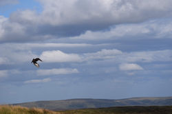 Flying Bird on The Crashed Plane Hike |  Walkers Near the The Crashed Plane Hike Route |  River in Devils Dike on The Crashed Plane Hike |
 Path Next to Devils Dike on The Crashed Plane Hike | 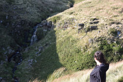 Girl Looking at Waterfall on The Crashed Plane Hike |  Valley on The Crashed Plane Hike |
 Girl Enjoying View on The Crashed Plane Hike |  Man on The Crashed Plane Hike |  Devils Dike on The Crashed Plane Hike |
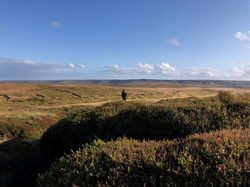
 Carved Stones Near Higher Shelf Stones on The Crashed Plane Hike |  Girl Walking on The Crashed Plane Hike Route |  The Crashed Plane Hike Vista |
 Walking Back to the Car on The Crashed Plane Hike |
hints & Tips
Avoid the Crowds
This hike has become extremely popular since the COVID-19 lockdowns of 2020 and 2021. The first few times I visited the crash site in early 2o18, my only company were a few sheep; now however, it's not unusual to find 20 or 30 people wandering around the debris field, for me, it really detracts from the atmosphere. If you want the place to yourself I would advise the below:
-
Visit on a weekday
-
Visit when it's raining, snowing or misty (experienced, well-equipped hikers only)
-
Visit during late evening or at night (experienced, well-equipped hikers only)
-
Avoid sunny days, bank holiday weekends and half terms
stick to the Route
Follow the circular route provided on this page, and don’t attempt to retrace your steps after you've reached the crashed plane (unless you are using a navigation device, have walked the route previously or have a map and compass and can use them). It's very easy to end up on the wrong trail out into the middle of the vast peaty moorland, terrain which can be extremely disorientating. If you do get lost and it's not foggy, just look for Snakes Pass (A57) and head in that direction, sooner or later you should reach it and then you can follow the road back to where you started.
consider the weather
-
Don’t attempt this hike in bad weather unless you're an experienced hiker and have a navigation app on your phone, a GPS device or a map and compass (which you can use), as well as suitable gear; getting lost on the moorlands in torrential rain and thick fog is not a fun experience.
-
The weather can turn quickly so be sure to wear appropriate footwear, and take waterproofs and layers as necessary. Start the walk early and check what time the sun will set; unless you're confident navigating at night.
-
The entire hike is very exposed, so on hot, sunny days make sure to pack plenty of water and sun cream as there is very little shade to be found. Finally, please note that it's usually very windy at Higher Shelf Stones, especially next to the trig point, so tread carefully and take care near cliff edges.
Facitlites & hospitality
There are no public toilets or hospitality venues around the immediate vicinity of the hiking route; therefore please make sure you take enough food and water to sustain yourself for the duration of the hike. The nearest places to get food are (the second location also has toilets):
-
The Ladybower Cafe ↗, a food van parked in a lay-by about a 12-minute drive east from the start of the hike. It serves hot and cold food as well as drinks and snacks (click here ↗ for more information).
-
The Upper Derwent Visitor Centre ↗ is located about 18 minutes east of the start point of the hike, at the very end of the Snakes Pass (postcode: S33 0AQ); there are toilets, refreshments and bike rentals (Click here ↗ for more information).
Interesting Facts
This link ↗ will take you to a first-hand account of one of the recovery party members, who was tasked with locating the plane and collecting the bodies of those who perished. Please note that the language is explicit and there are extremely gruesome descriptions of the human aftermath, so fair warning to the faint of heart. The account is harrowing, upsetting, and yet extremely well written; a few of my favourite quotes are:
... I looked up from the feet in front of me and suddenly I saw it. The huge B-29 tail fin rearing across the desolate moor up into the sky as if a huge gravestone had already been planted in commemoration
The rim had been created by the B-29 ploughing into the moor as if it had tried to bury itself to hide the shame of not being able to fly
Irregular mounds of white metal from the aircraft as it melted were everywhere, as if a foundry man had gone berserk and using the earth as his moulds had cast these useless shapes all over the site
Dominating over all that terrible place was the enormous tail fin of the dead B29, towering twenty five feet high, stark and foreign on that moor against the grey November morning but the only part of the aircraft recognisable
