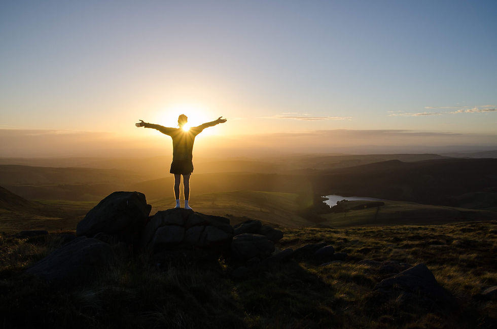
Overview
Home to the famous Jacob's Ladder, be sure to experience the wind-carved stones and incredible views of the Kinder Plateau
Kinder Scout lies at the heart of the Peak District, rich in both natural beauty and history. This vast stretch of open moorland was the site of the 1932 Mass Trespass, a landmark event that changed the future of public access to the countryside. Today Kinder Scout remains a symbol of that freedom, wild and windswept in many places, with peat bogs and heather stretching as far as the eye can see. Its remoteness and shifting weather make it both a challenge and a privilege to explore, offering a glimpse into the rugged heart of the Peaks.
This circular route begins in the peaceful village of Edale, surrounded by rolling hills and stone cottages. The trail climbs steadily through Grindsbrook Clough, where streams tumble between steep rocky sides before opening out onto the Kinder Plateau. Up here the land feels otherworldly, a maze of gritstone tors, weathered boulders and dark peat channels shaped over centuries by rain and frost. This trail is worth the effort, with sweeping views over the Edale Valley and across to the Great Ridge. From the plateau the descent via Jacobs Ladder offers a gentler return, with flagstone paths winding to the valley floor.
At 636 metres, the true summit of Kinder Scout is marked by a modest cairn, though most walkers aim for the nearby Kinder Low trig point at 633 metres. Both points capture the essence of the Peak District’s spirit, offering a feeling of vastness and solitude that few other places in England can match. The mix of raw terrain, changing weather and open horizons gives Kinder its lasting appeal, a landscape that challenges, inspires and always calls you back.
Go prepared, stay safe and enjoy the hike!
key info
duration: 4 - 6 hours
length: 8.3 miles
type: circular
total ascent: 562m
difficulty:
our rating:
Crowd levels: High
signage: LOW
toilets: Start ↗
parking
The hike starts at the High Peak Borough Council pay and display car park (postcode S33 7ZL), it's fairly reliable for getting a space and it's located next to the village hall in the centre of Edale. The car park is open 24 hours a day, 365 days a year, it's pay-and-display, and for cars it costs:
-
£1.60 for up to 1 hour
-
£2.50 for 1 to 2 hours
-
£4.00 for 2 to 4 hours
-
£6 for 4 to 10 hours
-
£7 for 24 hours
-
£120 for 3 months
For coaches and motorhomes, it costs:
-
£5.50 for up to 4 hours
-
£10.50 for over 4 hours
These prices are correct at the time of writing (October 2023) however for the most up-to-date pricing click here ↗. The parking ticket machines accept coins and you can pay using the PayByPhone app. There are 138 car parking spaces and it can fill up quickly depending on the time of year, the day of the week, and/or the weather, but there are always people coming and going and I've personally never had to wait for longer than 5 minutes.
There are several alternative car parks that are also located very close to the start of the hike; these alternatives can be found in the alternative parking section below and one of them is free. For those using public transport, click ''Directions'' on the map above and change the method of transport in the top left of the Google Maps page to ''Public Transport'' (the little blue train).
Alternative parking
3 minute walk to start of hike*
1 minute walk to start of hike**
2 minute walk to start of hike***
*Free layby which is nearly always full
**Costs £4 for 24 hours (correct as of November 2022) but there are only 20 spaces and strictly speaking they are for rail users
***Overflow to the main car park which costs £5 per day but is only open on weekends during the summer months (correct as of November 2022), bring cash
route map
Map Key
Play Route
Birds Eye View
Pause Route
Fullscreen
Restart Route
Zoom In
Centre Camera
Zoom Out
Cinematic View
Change Layer
Speed Control
route GUIDE
Disclaimer: This route description, map, GPX file, and any related information are provided for general reference only. Conditions on the ground can change at any time due to weather, erosion, access restrictions, livestock, or other factors. You are solely responsible for assessing whether this route is suitable for you, your party, and any dogs, and for making your own decisions regarding navigation, safety, equipment, and timing. Distances, ascent, durations, difficulty indicators, and route lines are approximate and should not be relied upon as exact or comprehensive. By using this guide, you acknowledge that walking and hiking involve inherent risks, and you accept full responsibility for your actions and outcomes. See our Terms of Use & Disclaimer page for more information.
Note: When hiking I use the Ordnance Survey phone app as my main navigation aid, supported by a paper map and compass for emergencies. The OL1 Explorer map covers this hike, it can be bought directly from the Ordnance Survey website here ↗ or from Amazon here ↗. When you buy the paper map it gives you a code that gives you free access forever to the digital version on the phone app. I have previously used the Ordnance Survey subscription ↗ service, it was amazing, but personally, I like to have both paper and digital maps for those rare times when my phone lets me down.
Note: The AllTrails map above does not include the detour to the Kinder Low trig point. I have submitted a new route which includes this detour but I am waiting for AllTrails to approve it. I thought it best to include this for now rather than having nothing at all.
1. Leave Edale car park via the main entrance and turn right. After about 10 meters the path will bear to the right heading down Marys Lane, continue to follow it and don't cross the road (see image 1). Head down Marys Lane, continue straight under the railway bridge (see image 2), past The Ramblers Inn on your left (see the Facilities & Hospitality section to see what they offer) and then past the row of stone houses, again on your left. Note: After the pub, the path ends and you will have to walk on the road (this is still Marys Lane), so please be careful. The road will start to bear to the right, continue along it passing the Moorland Centre and then the graveyard, both of which are on your right, and then on past the stunning church further up the road on your left. Keep walking down Marys Lane until you reach the village centre and can see the Old Nags Head pub on the right side of the road (see the Facilities & Hospitality section to see what they offer). Walk past the pub and continue along the road until it narrows and turns into a gravel path which will take you past some lovely houses with large beautiful gardens, and eventually, you will reach a white gate with a wooden sign just to the right of it with the words "Grindsbrook" (see image 3), pointing off into the forest.
2. Follow the path through the forest, down the steps, across the wooden bridge, up the stairs and then out of the forest. Once you leave the forest the path will change to beige paving slabs, continue along this paved path for around 700 meters (which will take around 8 minutes at an average walking pace) until you reach a small wooded area where the path changes from paving stones to dirt. Head through the wood following the defined path until you reach a gate, go through it and there will be a small wooden bridge over a river (see image 4). Head over this bridge, up the stone steps to the left and continue along the clearly defined rocky and sandy-coloured dirt path. You're going to be on this path for around 850 meters until you reach the rocky section of Grindsbrook Clough; at a normal walking pace, it will take you between 10 to 15 minutes to complete this section, assuming you don't stop to take photos (see image 5 for an aerial photo which shows the route from the bridge by the woodland to the start of the rocky section of Grindsbrook Clough). If you pass through the gate shown in image 6 on the way to the rocky section, you know you're going the right way.
3. As you begin to approach the rocky section of the clough, you'll notice an abundance of boulders scattered along the path. As you continue, the path becomes progressively less defined until you reach a junction where the valley diverges into two separate routes, take the one to the left (as indicated in image 7 and image 8). You will quickly gain elevation until you reach the top of the Kinder plateau which is marked by a prominent cairn ↗ (as seen in image 9). If, by chance, you take the wrong path and end up following the one to the right, don't worry. You'll still eventually reach the top of the plateau; if there isn't a cairn there you need to turn left and follow the defined path (see image 10) whilst it hugs the edge of the cliff until you reach the cairn and you can then pick up from step 4.
4. From here, face the cairn. To its left is a clearly defined stone path (see image 11), and to the left of that a second dirt path that hugs the top of the valley edge (also see image 11). Take this second path and follow it for around 400m (about a 5 minute walk) until you pass a small cairn, then continue on to the summit of Grindslow Knoll, marked by a large cairn (see image 12 for the view from the top). Once you have bagged the Ethel, stand with the Grindslow Knoll cairn behind you. Ahead and to your right is the path you have just walked; to your left is another path, which is the one you need to take (see image 12). Follow this path for roughly 700 m (about 8 minutes at an average pace) until it becomes sandy coloured gravel and ends at a T junction, turn left here. The path will then change into stone paving slabs and later a rocky trail. After some distance, you will reach a very shallow stream crossing downhill (in very dry periods it may disappear). Cross straight over, go up the stone steps, and continue following the path. It will alternate between dirt, gravel and stone paving, but keep going straight until you reach an area scattered with large, oddly shaped boulders (see image 13 and image 14).
5. You have now reached Woolpacks, this stunning part of the plateau is a collection of naturally sculptured boulders which on a misty evening really can feel eerie. Continue through Woolpacks until you reach the other side, the path through it is pretty obvious and easy to follow. Once you reach the other side, the path will turn from dirt and mud to stone paving and back again at various points. Continue to follow this path until you reach another cairn, it's about 1,350 meters from when you leave Woolpacks which will take you around 20 minutes to walk. At this cairn, you are going to take a little detour from the path to reach the trig point and Kinder Low, shows the route from Woolpacks to the cairn. Take the right path at the junction by the cairn and follow it until you reach the white trig point, image 15 shows the route from Woolpacks, to the cairn, then to the trig point at Kinder Low. Image 16 shows the trig point.
6. Once you have admired the trig and the view, retrace your steps and head back to the cairn. When you reach it turn right and continue your journey along the same path as if you had never made the detour to the trig point. Eventually, you'll pass another smaller cairn on your right and then reach a point where the stone paving ends; about 40 meters from here you will be presented with two paths, a smaller and less defined one heading right up a hill, and a larger path heading left and downhill, you want to take the larger path heading left and downhill. After perhaps another 50 meters, you will again be presented with two paths, again choose the left path which heads downhill. Image 17 shows the route from the first cairn (where you turned to reach the trig point) to just after the second path split, making it clear which path you need to take each time. If you keep following this path you will end up on a paved section again; there is a point about 70 meters from the start of this paved section (about 1 minute 30 seconds walk) where it splits off to the right and then becomes a dirt path, you don't want to go that way, stay on the paved path which bends to the left. The paving will eventually end and from here you can turn left or right, turn left and follow the path, which will now consist of dirt and rocks, until you reach the cairn shown in image 18. From where you turn left at the end of the paved path to the cairn is about 500 meters, which will take about 7 minutes to walk.
7. Once you reach the cairn, turn left, you are now at the top of the famous Jacobs Ladder. The route heads downhill and will turn from dirt and rocks to paved steps part way down, there will also be a small wooden fence with metal wire to your right. Continue on this easy-to-follow route until you reach the bottom, where you will find yourself in front of The Packhorse Bridge (see image 19). Cross the bridge, head through the wooden gate and follow the well-defined path for around 1 mile (which will take about 25 minutes) until you see a traditional red British phone box (see image 20) where you need to turn left and head into the Upper Booth Farm complex (the route through is a public right of way). Walk through the yard and through the wooden gate (see image 21 for the route through the farm). Turn left after walking through the wooden gate, walk for about 20 meters and then turn right and go through the rightmost wooden gate (note there are 3 wooden gates in this location, make sure you take the rightmost gate). Follow this route for around 1,800 meters until you reach the gate and sign shown in image 22 (this will take around 25 minutes to walk). You'll be heading through the stunning Edale Valley here, where you can see Mam Tor and Back Tor in the distance. You'll walk through multiple gates on this route, the path is very well-defined and easy to follow, image 23 shows a high-level view of the route you will take from Upper Booth Farm to the gate and sign.
8. You're now on the final stretch home, go through the gate, turn right and follow the path until you reach the centre of Edale village. The school will be directly ahead of you, and the Nags Head Inn will be to your left. Turn right and follow Marys Lane all the way back to the railway bridge, which you should pass under. Continue straight to the end of the road and turn left and then left again, you will now be back in the main car park where you started the hike from.
.png)


Direction of Travel

Direction of Travel


Direction of Travel


Direction of Travel

Grindslow Knoll Summit Cairn
Path to Grindslow Knoll
Path from Grindslow Knoll

Cairn
To Grindslow Knoll
From Grindslow Knoll
Dirt Path
Defined Stone Path


Direction of Travel


Direction of Travel

weather
kinder scout
other forecasts
gallery
 Jacob's Ladder Sign on the Kinder Scout Hike |  Kinder Low Trig Point During Winter |  Grindsbrook Sign on the Kinder Scout Hike |
|---|---|---|
 Edale Valley on the Kinder Scout Hike |  Edale Cottage on the Kinder Scout Hike | 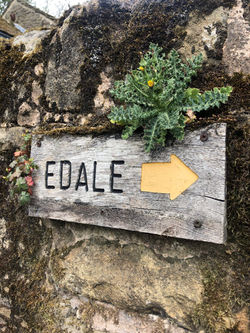 Edale Sign on the Kinder Scout Hike |
 Edale Chruch on the Kinder Scout Hike |  Unsual Rock Formation on the Kinder Scout Hike |  Route to Kinder Scout |
 Sunset on the Kinder Scout Hike |  Pennine Way on the Kinder Scout Hike |  Cairn at Sunset on Kinder Scout Hike |
 Wooden Gate on the Kinder Scout Hike |  Wooden Bridge on the Kinder Scout Hike | 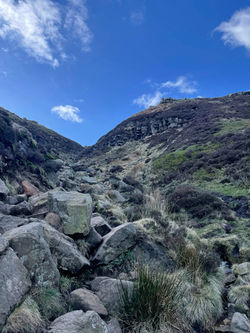 View up Grindsbrook Clough on the Kinder Scout Hike |
 View on the Kinder Scout Hike | 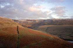 View Over Kinder Scout |  View From Kinder Scout |
 Sunset at Kinder Scout |  Stunning Edale Valley on the Kinder Scout Hike |  Small Stream on the Kinder Scout Hike |
 Railway Bridge at the Start of the Kinder Scout Hike |  Route to Grindsbrook Clough on the Kinder Scout Hike |  Pennine Way Sign on the Kinder Scout Hike |
 Pack Horse Bridge on the Kinder Scout Hike |  Pennine Way Map on Gate on the Kinder Scout Hike |  Old Land Rover on the Kinder Scout Hike |
 Moody Edale Valley on the Kinder Scout Hike |
hints & Tips
consider the weather
-
Don’t attempt this hike in bad weather unless you're an experienced hiker and have a navigation app on your phone, a GPS device or a map and compass (which you can use), as well as suitable gear; getting lost on the plateau in a snowstorm is not fun (well it was, but it was also scary and not very safe 🤷♂️)
-
The weather can turn quickly so be sure to wear appropriate footwear, and take waterproofs and layers as necessary. Start the walk early and check what time the sun will set; unless you're confident navigating at night
-
On hot, sunny days make sure to pack plenty of water and sun cream as there is very little shade to be found
Facilities & Hospitality
Toilets:
-
Edale Car Park ↗: I'm unsure if you need to pay so take coins and a card just in case*
-
The Rambler Inn ↗: Located north of the car park, it's on your left just after the railway bridge
-
Old Nags Head Pub ↗: Located at the end of Marys Lane in the centre of the village
*I've never actually used the Edale car park toilets so I'm not sure if you have to pay. I'll check next time I'm around there but if anyone knows, please use the contact form in the footer and let me know 😊
Wi-Fi:
-
Edale Train Station ↗: Turn right out of the car park main entrance, then take your first right and follow the signs for the station
-
The Rambler Inn ↗: Located north of the car park, it's on your left just after the railway bridge
-
Old Nags Head Pub ↗: Located at the end of Marys Lane in the centre of the village
Food & Drink:
-
The Penny Pot Cafe ↗: Turn right out of the main car park entrance, then take your first right and then your first left. More info ↗.
-
The Rambler Inn ↗: Located north of the car park, it's on your left just after the railway bridge. Food menu ↗.
-
Old Nags Head Pub ↗: Located at the end of Marys Lane in the centre of the village. Food Menu ↗.
Accommodation:
-
The Rambler Inn ↗: Located north of the car park, it's on your left just after the railway bridge. Book a room ↗.
-
Old Nags Head Pub ↗: Located at the end of Marys Lane in the centre of the village. Book a room ↗.
Interesting Facts
The 1932 mass trespass, also known as the Kinder Trespass, was a significant event in the history of the British rights-of-way movement. On April 24, 1932, a group of over 400 hikers and ramblers marched onto Kinder Scout, a moorland in the Peak District, to protest against the exclusion of the public from much of the country's open countryside. This peaceful demonstration marked a turning point in the struggle for access to Britain's rural landscapes, and paved the way for the creation of national parks and the eventual expansion of the public rights-of-way network.
Although the trespass was met with resistance from gamekeepers and police, no serious violence occurred and five of the protesters were eventually sentenced to prison terms for their actions. Despite this, the Kinder Trespass inspired a nationwide movement for greater access to the countryside, and its legacy can still be seen today in the form of the extensive network of footpaths and open spaces that are accessible to the public. The Kinder Trespass remains an important symbol of the fight for the public's right to roam, and serves as a reminder of the importance of preserving and protecting access to our natural heritage for future generations. Click here ↗ if you'd like to learn more.
